HOME | ABOUT US | MEDIA KIT | CONTACT US | INQUIRE
HOME | ABOUT US | MEDIA KIT | CONTACT US | INQUIRE
If you want to understand the history of real-estate development in the Kansas City region over the past 160 years—a history back-loaded with activity since the end of World War II—you can dig through the archives in libraries or historical societies in the region, and you can be buried in the details of how it all came together.
Or you can climb into the mind of Whitney Kerr, a senior vice president at Cassidy Turley Commercial Real Estate Services, and go along for an enlightening and informative ride. Over the nearly six decades since he started as an intern for Kansas City’s planning commission, Kerr has been involved in many of the signature developments that have shaped the regional marketplace today.
He’s witnessed the explosion of growth that made Johnson County an economic engine for the region—helped pave the way for it, in fact—and he’s seen Downtown fade from glory and start its long climb back. From the origins of the Corporate Woods office park to Leawood Town Center, from the Park Place development to the redevelopment near the old Bannister Mall site, Kerr has seen the good, the bad and the ugly of real-estate development in the region.
A thousand factors played contributing roles in producing a metro area nearly 60 miles in diameter, from Excelsior Springs to Gardner, but one—the eternal link between real estate and money—stands out. An asset Kansas City has long had lots and lots of—cheap land—underpinned almost all of what’s happened during Kerr’s career.
“Downtown property was $70 a square foot in 1958,” he recalls. “A few years later, when I was putting land together for Corporate Woods, it was 25 cents a square foot.”
Therein lay the incentive for growth from the central core of Kansas City, first to the south and southwest, then leapfrogging the Missouri River for the vast expanse of the Northland, and in later years, into western Wyandotte County and the exurban counties.
Many factors opened those channels for development, including the creation of the Country Club District that would redefine residential home development and set standards for construction quality and plan design—and become home to the vast majority of business executives and decision-makers who wanted to live near the companies they owned or managed.
What followed, Kerr said, was a series of planning mistakes, misguided traffic-management approaches, short-sighted municipal and state policies with land use and acquisition, and unstoppable market forces that produced the Kansas City realty market we know today.
In the Beginning . . .
Think about the hundreds of billions of dollars expended in development in the Kansas City metropolitan area over the past 150 years—from the central business district Downtown to the far reaches of today’s exurbia—the residential housing construction, the rise of shopping hubs and malls, the emergence of corporate office spaces, retailers and restaurants demanding hundreds of thousands of workers. Think of the highway systems constructed to connect them, the schools, museums and theaters that education and entertain them, the golf courses, rec centers and ball fields that they play on.
In a very real sense, every bit of that can be traced to a single historical development: Completion of a quarter-mile span across the Missouri River in 1869, in what would be known for the next 40 years as the Hannibal Bridge.
“The impetus for expansion and growth in Kansas City was the Hannibal Bridge,” says Steven Noll, executive director of the Jackson County Historical Society. Kansas City, he said, “beat out a number of cities to get that bridge, and it was the reason the West Bottoms became an important industrial area. With the bridge, the railroad came to town, and that fueled Kansas City’s explosive growth.”
The rest, they might say, is developmental history. From storied names like Thomas Swope (who moved here a dozen years before the bridge was open) and J.C. Nichols (who was born in Olathe the same year Swope arrived in Kansas City), the Kroh brothers and the Vawter family and legions of others, this region’s development history is what links seemingly disparate communities across a Metropolitan Statistical Area that covers more than 7,850 square miles. From Bonner Springs to Excelsior Springs to Blue Springs, a look back at the region’s developmental history invariably takes us back to July 3, 1869, when 40,000 people gathered to see the bridge opened.
Most of them had been part of a westward expansion that had made Kansas City a rising star of commercial activity—after all, only 4,000 of them had been living here at the end of the Civil War, just four years earlier. But on the riverbank that day, they knew something big was starting to happen.
Building the Nucleus
What followed for the better part of a century was truly a tale of two cities, in two states. For the next 80 years, until the guns fell silent after World War II, the Kansas City area consisted largely of two municipalities rent by a state line. The Census figures tell the story: On the Missouri side, Kansas City had no official population in the 1850 head-count, but half a century later, it was home to 164,000 people—a figure that soared to 248,000 just a decade later.
Even the little brother to the booming metro east of the state line, Kansas City, Kan., nonetheless saw its own boom:
from 3,200 residents in 1880, it grew by nearly 1,100 percent in a decade, to 35,116, and by more than a third again at the turn of the 20th century, to more than 51,000 people.
That influx of people created significant wealth for land merchants like Thomas Swope, whose personal fortune enabled him to bequeath to his adopted city nearly three square miles of land that today make up the city’s largest park, named in his honor. That’s more than twice the acreage of New York’s famed Central Park.
And it led a developmental push for ever-more land, first off of what today is Quality Hill on Downtown’s west side, into the areas of Union Hill and Little
Italy, and what we know today as Midtown, all the way down to swampland along a place called Brush Creek and the Westport area, a tract well away from the Missouri River flood plain and first set-tled by pioneers like John Calvin McCoy, along with names like Jim Bridger and Pony Express co-founder Alexander Majors.
The maxim of real-estate development—first the rooftops, then the retail—was also at work in that era, as the lands around isolated farmsteads began to fill in, creating the critical mass needed for the tradesmen, craftsmen and retailers to flourish. But another part of the puzzle was employment, with jobs moving to the suburbs, and people seeking homes near their work.
Even before Kansas City came to be as the Town of Kansas, the region’s first settlers landed in Liberty, in 1822—just a generation after Lewis & Clark first explored the Missouri River basin. That preceded even the founding of Independence five years later, and more than a decade before what would become Kansas City.
In the run-up to the Civil War the years that followed, the pillars of what we know as the metropolitan area’s suburbs were set—Olathe’s first settlers arrived in 1857, Lee’s Summit was founded as the Town of Strother in 1865. Curiously, Overland Park—second only to Kansas City, Mo., today in metropolitan-area population—wasn’t even incorporated as a city until nearly a century later, in 1960.
For decades, development came in piecemeal fashion in a bustling, largely unregulated, unplanned aggregation of towns simply coping with the infusion of bodies from the east.
Within that construct, the two Kansas Citys grew and came to dominate the region. That was largely because the railroads were coming through, creating the means to ship grain, beef and other products to the population centers in the east. The Hannibal Bridge, of course, would play a role in that, as would the other spans that would make this region second only to Chicago in its strategic position as a major national center for rail shipping.
But as the population grew, and shed some of its raw-boned, frontier mentality, development was about to embrace a more dignified, structured approach. And the credit for much of that goes to one Jesse Clyde Nichols.
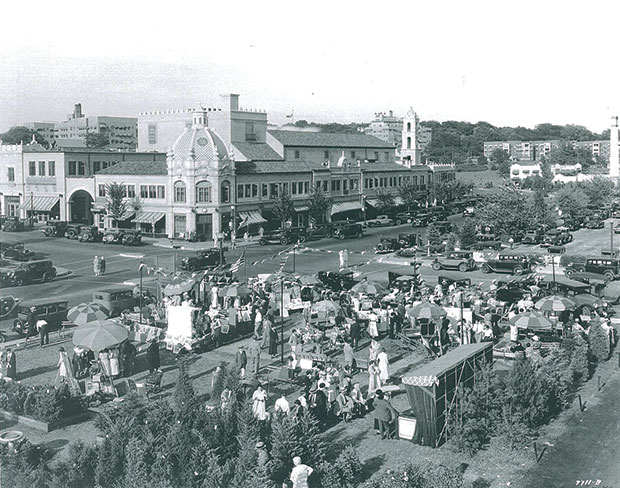
The Country Club Plaza and District
He might have been Kansas City’s first version of Local Boy Makes Good. Born in Olathe in 1857, Nichols was educated at the University of Kansas, then went east to Harvard before coming back home to quite literally change the face of the city. He had a vision for what Kansas City could—should—look like, and it was grounded in something he called “planning for permanence.”
Rather than houses go up willy-nilly, with retail following sporadically, he envisioned entire residential neighborhoods of well-groomed lots, the kinds of homes that would engender a sense of pride and inspire homeowners to keep them maintained. He had already tested an early version of that approach in developing what are now the Valentine and Coleman Highlands neighborhoods what today is Midtown Kanas City, shortly after the turn of the 20th century.
But as development pushed farther south, toward that Brush Creek swampland, Nichols added a signature element: a retail center unlike no other in the world. Influenced by the architecture of Barcelona, he would call it the Country Club Plaza, and it would be part of a retail-residential dynamic that would stretch from the rise south of the Plaza into Kansas. Neighborhoods like South Plaza, Sunset Hill, Armour Hills, Armour Fields, Brookside, Mission Hills, Fairway, Prairie Village came next—some even incorporating as cities—but creating a vast swath of higher-end, quality homes with tree-lined streets and wide boulevards.
During J.C. Nichols’ career and with the assistance of his son Miller Nichols, who would continue the legacy another fifty years, their development became the largest planned community executed by a single developer anywhere in the United States, and the work went on for decades, right up until his death in 1950. What he left behind was a developmental legacy that has defined much of the residential realty market in the region, Kerr said, because competitors had to up their game, as well.
“There’s no question” that Nichols was a standard bearer, Kerr said. “It helped that his brokerage company would not represent owners who were in non-
Nichols-developed areas, but he did develop a mystique about living in a Nichols district, which was also true of the Kroh Brothers. They set a high stand-
ard in terms of layout and design, sub-division planning, and that had a very positive influence on the quality of life in the city.”
Nichols lived long enough to see the American Dream come to full flower, with hundreds of thousands of GIs, sailors and airmen coming back from a global war after 1945.
And that was when the dam of consumer demand broke. The developmental flood that followed would wash across neighboring Johnson County, extend north into Clay and Platte counties, and eventually reach the fringes of western Wyandotte County and the next concentric circle of counties around that core.
The Suburbs
If the first century of development belonged to the two Kansas Citys, the second would belong to a comparatively unlimited number of municipal actors. Johnson County would become an economic engine in its own right, growing to surpass every other burg in population save Kansas City, Mo., itself. Kansas City today is flanked by a city of 116,000 on its eastern border, Independence, and will shortly be blocked from further southern expansion to the southeast by another six-figure population as Lee’s Summit nears that threshold.
Overland Park, the heavyweight in Kansas with a population over 175,000, is itself bracketed by Olathe’s 130,000 residents, 50,000 more to the west in Lenexa, and 63,000 in Shawnee.
In the booming Northland, Platte County has been through a burst that made it the leader in net new jobs among counties in the region in recent years, even though its population is still shy of six figures. Neighboring Clay County, in part riding a developmental boom fostered by the presence of Interstate 35, has grown past 227,000.
What’s interesting about the growth in each of those is the varying time frames. We think of Kansas City as having expanded in a series of concentric circles. A glance at the map might reinforce that notion, but the development has been far more erratic in building toward that complete picture.
Here, again, is where the Census figures tell the story, and nowhere more dramatically than in Johnson County. From the time it first appeared on the Census radar as a blip of 13,684 people in 1870, the future powerhouse sat largely idling—after a 23.2 percent increase in the 1880 census, the rates over the next half-century there were 3.2 percent, 4.1 percent, 1 percent and, remarkably, 0.1 percent from 1910 to 1920. That means the population of Johnson County, Kansas, grew by exactly 26 people in the second decade of the 20th century.
After a respectable 15.6 percent bump in the 1930 census, the lid came off: the next decade, just before World War II, saw growth of 57.4 percent. Growth would not fall below that level for the next 40 years, until the 1980 census. In the meantime, the once-sleepy county has added nearly 100,000 people every decade since 1960.
Much of that was coming at the expense of neighboring Jackson County. After averaging population growth of nearly 75 percent for 10 straight census periods, the string was broken in 1940—1.6 percent growth. The next two census periods were the last ones in which the county saw double-digit population increases, with a low-water mark in 1980, when it recorded a 3.86 percent decline.
Nothing illustrates the difference between a natural barrier like a river and a political boundary, like a state line, better than Clay County. In 1930, it was more populous than Johnson County—26,811 to 21,179. And even nine straight census periods of double-digit increases, capped by a 93.4 percent record in 1960, have been able to keep it on pace with Johnson County’s growth, fueled by easy access into the Missouri side from across that state line.
Platte County didn’t come into its own as a growth market until 1960, with a 55.9 percent increase. For an astonishing 110 years, from 1840 until 1950, the county’s population actually declined, from 16,842 to 14,973. Things began to take off—literally—after Kansas City International Airport was built in the early ’70s, and the county has averaged double-digit growth each decade since.
A huge amount of the suburban growth, Kerr notes, stemmed not just from easy access to cheap land in the south and southwest, but from bad policy decisions that in effect compelled businesses to leave the central core for the suburbs. One was the creation of the Downtown loop, when the city rejected an entreaty by the late hotelier Barney Allis to draw the circle much wider, with 20th Street as a southern boundary, rather than Truman Road.
Once finished, the interstate noose choked off development in a Downtown that was still following plats laid out in the 1950s, with utility lines running down the alleys. Those would later form a prohibitively expensive barrier to redevelopment with larger buildings that needed a much larger footprint. Another was Missouri’s decision during construction of the interstates to acquire rights-of-way only at key interchanges, while Kansas secured enough land on either side of I-35 to put in the frontage roads that would become key parts of the business infrastructure.
With employers moving to the fringes, workers followed, generating demand for what are now inner-ring suburban residential tracts that, like an onion, had additional rings of growth around them for decades.
What’s Next?
The way Kerr sees things, what was old will be new again. Demand for urban lifestyles—walkable streets, public transportation, ready access to work, entertainment and cultural venues—is drawing young people back Downtown, in Kansas City and most other major urban areas.
“What’s going to happen? My guess is it will be, instead of cities shaped like onion skins with concentric rings, the pattern will see town centers with higher density, like Leawood now, and Lenexa is building, more like a cluster of grapes, with the stems holding together the interstates,” Kerr said. Even in the suburbs, cities are beginning to embrace higher density and the economic consequences of low-density policies that force real-estate rents to unsustainable levels.
“When I was at Princeton and had to write my undergrad thesis, I was interested in urban renewal,” a nascent concept in the mid-50s, Kerr said. “I wrote about the actions necessary to increase urban renewal, like Section 353 financing. Looking back, I understood and predicted what would happen to
the city and the suburbs—and it turned out to be almost what I expected.”